


Munckton Gold and Silver Mining Co. - Gorgeous Unissued Mining Stock Certificate
Inv# MS1569 Stock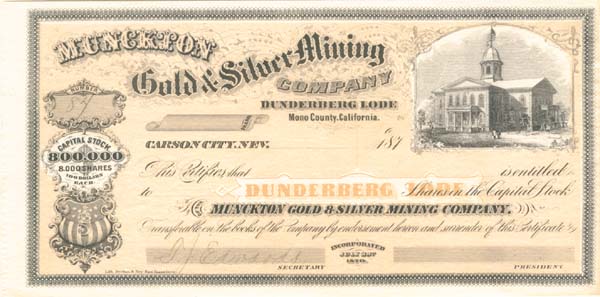
Nevada
Unissued Stock. Lith. Britton & Rey, San Francisco. Dunderberg Lode, Mono County, California.
Mono County is a county located in the east central portion of the U.S. state of California. As of the 2020 census, the population was 13,195. making it the fourth-least populous county in California. The county seat is Bridgeport. The county is located east of the Sierra Nevada between Yosemite National Park and Nevada. The only incorporated town in the county is Mammoth Lakes, which is located at the foot of Mammoth Mountain. Other locations, such as June Lake, are also famous as skiing and fishing resorts. Located in the middle of the county is Mono Lake, a vital habitat for millions of migratory and nesting birds. The lake is located in a wild natural setting, with pinnacles of tufa arising out of the salty and alkaline lake. Also located in Mono County is Bodie, the official state gold rush ghost town, which is now a California State Historic Park.
Mono County was formed in 1861 from parts of Calaveras, Fresno and Mariposa counties. A portion of northern Mono County contributed to the formation of Alpine County in 1864; parts of the county's territory were given to Inyo County in 1866.
The county is named after Mono Lake which, in 1852, was named for a Native American Paiute tribe, the Mono people, who historically inhabited the Sierra Nevada from north of Mono Lake to Owens Lake. The tribe's western neighbors, the Yokuts, called them monachie, meaning "fly people" because they used fly larvae as their chief food staple and trading article.
Archeologists know almost nothing about the first inhabitants of the county, as little material evidence has been found from them. The Kuzedika, a band of Paiute, had been there many generations by the time the first anglophones arrived. The Kuzedika were hunter-gatherers and their language is a part of the Shoshone language.
Dunderberg Peak is located east of the Sierra Nevada crest near the divide between the Mono Basin and East Walker River basin (Conway Summit) in Mono County, in eastern California in the southwestern United States. The peak is in the Hoover Wilderness and is the highest point in Humboldt-Toiyabe National Forest.
Dunderberg Peak, originally named Castle Peak, was renamed by a party of the Wheeler Survey after the mines upon its northerly slope in 1878.
Also mentions Carson City, Nevada:
Carson City, officially the Consolidated Municipality of Carson City, is an independent city and the capital of the U.S. state of Nevada. As of the 2020 census, the population was 58,639, making it the sixth largest city in Nevada. The majority of the city's population lives in Eagle Valley, on the eastern edge of the Carson Range, a branch of the Sierra Nevada, about 30 miles (50 km) south of Reno.
The city is named after the mountain man Kit Carson. The town began as a stopover for California-bound immigrants, but developed into a city with the Comstock Lode, a silver strike in the mountains to the northeast. The city has served as Nevada's capital since statehood in 1864; for much of its history it was a hub for the Virginia and Truckee Railroad, although the tracks were removed in 1950. Before 1969, Carson City was the county seat of Ormsby County. The county was abolished that year and its territory merged with Carson City. With the consolidation, the city limits extend west across the Sierra Nevada to the California state line in the middle of Lake Tahoe. Like other independent cities in the United States, it is treated as a county-equivalent for census purposes. Carson City is one of two state capitals that border another state, the other being Trenton, New Jersey.
The Washoe people have inhabited the valley and surrounding areas for about 6,000 years.
The first European Americans to arrive in what is now known as Eagle Valley were John C. Frémont and his exploration party in January 1843. Fremont named the river flowing through the valley Carson River in honor of Kit Carson, the mountain man and scout he had hired for his expedition. Later, settlers named the area Washoe, in reference to the indigenous people.
By 1851, the Eagle Station ranch along the Carson River was a trading post and stopover for travelers on the California Trail's Carson Branch, which ran through Eagle Valley. The valley and trading post received their name from a bald eagle that was hunted and killed by one of the early settlers and was featured on a wall inside the post.
As the area was part of the Utah Territory, it was governed from Salt Lake City, where the territorial government was headquartered. Early settlers bristled at the control by Mormon-influenced officials and desired the creation of the Nevada territory. A vigilante group of influential settlers, headed by Abraham Curry, sought a site for a capital city for the envisioned territory. In 1858, Abraham Curry bought Eagle Station and the settlement was thereafter renamed Carson City. Curry and several other partners had Eagle Valley surveyed for development. Curry decided Carson City would someday serve as the capital city and left a 10-acre (40,000 m2) plot in the center of town for a capitol building.
After gold and silver were discovered in 1859 on nearby Comstock Lode, Carson City's population began to grow. Curry built the Warm Springs Hotel a mile to the east of the city center. When territorial governor James W. Nye traveled to Nevada, he chose Carson City as the territorial capital, influenced by Carson City lawyer William Stewart, who escorted him from San Francisco to Nevada. As such, Carson City bested Virginia City and American Flat. Curry loaned the Warm Springs Hotel to the territorial Legislature as a meeting hall. The Legislature named Carson City to be the seat of Ormsby County and selected the hotel as the territorial prison, with Curry serving as its first warden. Today, the property is still part of the state prison.
When Nevada became a state in 1864 during the American Civil War, Carson City was confirmed as Nevada's permanent capital. Carson City's development was no longer dependent on the mining industry and instead became a thriving commercial center. The Virginia and Truckee Railroad was built between Virginia City and Carson City. A log flume was also built from the Sierra Nevada into Carson City. The current capitol building was constructed from 1870 to 1871. The United States Mint operated the Carson City Mint between the years 1870 and 1893, which struck gold and silver coins. People came from China during that time, many to work on the railroad. Some of them owned businesses and taught school. By 1880, almost a thousand Chinese people, "one for every five Caucasians", lived in Carson City.
Carson City's population and transportation traffic decreased when the Central Pacific Railroad built a line through Donner Pass, too far to the north to benefit Carson City. The city was slightly revitalized with the mining booms in Tonopah and Goldfield. The US federal building (now renamed the Paul Laxalt Building) was completed in 1890 as was the Stewart Indian School. Even these developments could not prevent the city's population from dropping to just over 1,500 people by 1930. Carson City resigned itself to small city status, advertising itself as "America's smallest capital". The city slowly grew after World War II; by 1960, it had reached its 1880 boom-time population.
As early as the late 1940s, discussions began about merging Ormsby County and Carson City. By this time, the county was little more than Carson City and a few hamlets to the west. However, the effort did not pay off until 1966, when a statewide referendum approved the merger. The required constitutional amendment was passed in 1968. On April 1, 1969, Ormsby County and Carson City officially merged as the Consolidated Municipality of Carson City. With this consolidation, Carson City absorbed former town sites such as Empire City, which had grown up in the 1860s as a milling center along the Carson River and current U.S. Route 50. Carson City could now advertise itself as one of America's largest state capitals with its 146 square miles (380 km2) of city limits.
In 1991, the city adopted a downtown master plan, specifying no building within 500 feet (150 metres) of the capitol would surpass it in height. This plan effectively prohibited future high-rise development in the center of downtown. The Ormsby House is the tallest building in downtown Carson City, at a height of 117 feet (36 m). The structure was completed in 1972.
A stock certificate is issued by businesses, usually companies. A stock is part of the permanent finance of a business. Normally, they are never repaid, and the investor can recover his/her money only by selling to another investor. Most stocks, or also called shares, earn dividends, at the business's discretion, depending on how well it has traded. A stockholder or shareholder is a part-owner of the business that issued the stock certificates.


Ebay ID: labarre_galleries